Latest News
Cyclone Murasu likely to intensify into severe cyclonic storm
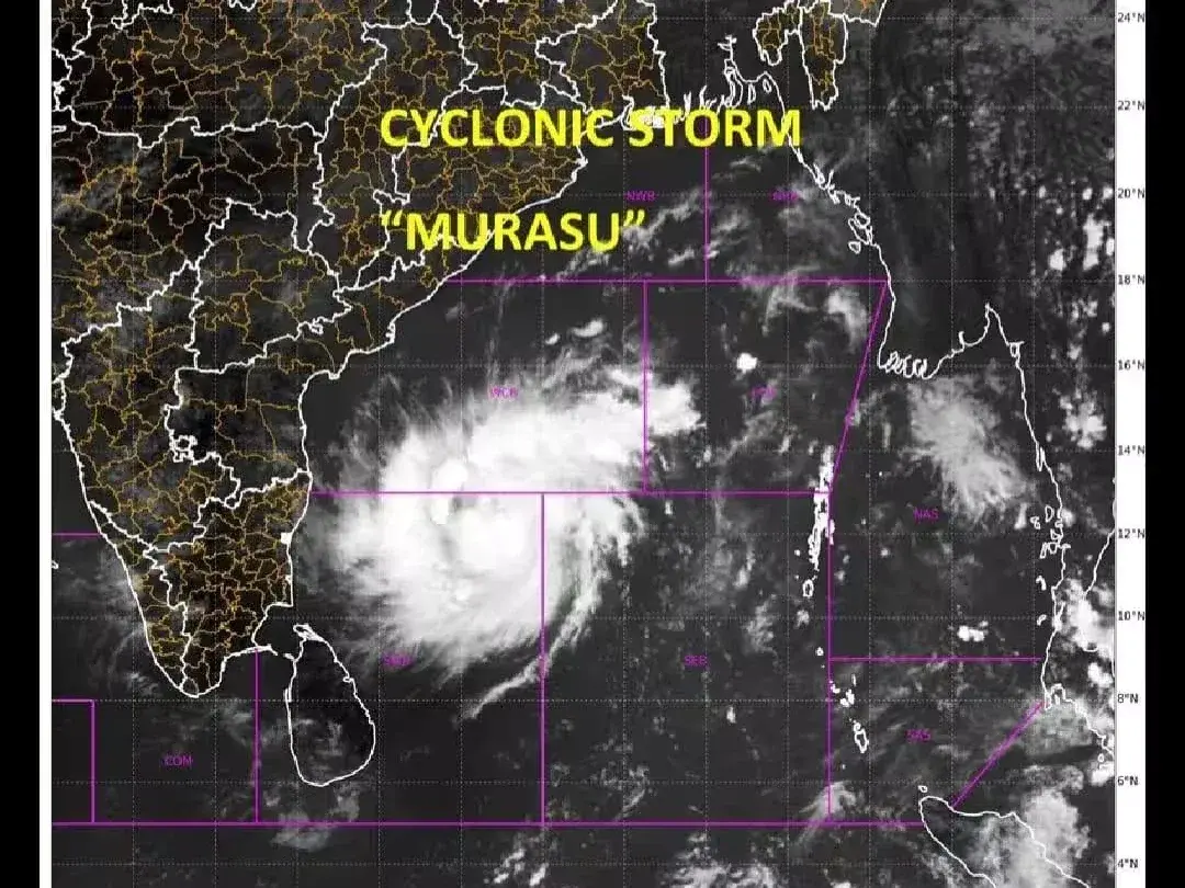
Cyclone Murasu, located over the west-central and adjoining south-west Bay of Bengal, is likely to intensify into a severe cyclonic storm, the Department of Meteorology said.
At 11.30 p.m. on November 1, the system was centred near latitude 13.3°N and longitude 83.0°E, about 480 km north-north-east of Kankesanthurai.
The department said the system was very likely to move west-north-westwards across the west-central Bay of Bengal during the next three hours and strengthen further into a severe cyclonic storm.
It is then expected to move north-westwards and cross the southern Andhra Pradesh coast of India between Nellore and Narsapur as a severe cyclonic storm between midnight on November 2 and the early hours of November 3.
Fishermen and naval vessels have been advised to avoid sea areas between 10°N and 17°N and 80°E and 90°E until further notice. Those already operating in these waters have been asked to move to safer areas.
Fishing and naval activities have also been suspended in deep and shallow waters from Mannar to Trincomalee via Kankesanthurai until further notice.
The Meteorology Department urged fishing and naval communities to remain alert to further forecasts and warnings.
Showers or thundershowers are expected at several places in the seas around the island.
Winds around Sri Lanka will generally be south-westerly or southerly at 25–35 km/h, increasing at times to 40–45 km/h in sea areas from Chilaw to Pottuvil via Colombo, Galle and Hambantota.
Those waters may become fairly rough at times, while other sea areas around the island are expected to be slightly rough.
During thundershowers, temporary strong winds of 60–70 km/h may occur, making the affected sea areas temporarily very rough.
Share this story
RELATED NEWS
View all

Latest News
TIN mandatory for several transactions from today
Nov 02, 2026

Latest News
Government to extend cultivation subsidy to 12 food crops
Nov 02, 2026

Latest News
Fuel prices increased; bus fares unchanged as three-wheeler operators seek higher charges
Nov 02, 2026

Latest News
Sri Lanka’s fuel import bill rises 51.5% to US$4.49 billion
Nov 01, 2026